
Trace a Burleson Street by Address
A street search has a firm order in Burleson. Normalize the address first, then use the city map to locate the parcel and its county side. The appraisal or tax record can supply a parcel, legal description, owner name, and separate mailing line. That information leads to the appropriate county recorder, where grantor and grantee entries can extend the ownership trail. A public election lookup is not a block roster and does not prove present occupancy. Historical newspapers and a licensed directory scan, if one is located, can add dated context without turning an address record into a private household list.
- Use USPS address validation and retain the returned address line, unit, ZIP or ZIP+4, and date checked.
- Open the Burleson GIS layers to identify the parcel, city-limit status, and whether Johnson or Tarrant County holds the related county records.
- Search the matching CAD, tax, or appraisal system by address, account, owner, or georeference, then keep situs, mailing, and legal-description fields distinct.
- Follow the legal description through the relevant official-record index, recording each deed date, party, document number or book and page, and available image link.
- For an older address, search digitized newspapers by street and name, and ask the library whether a licensed city-directory scan is available.
That sequence is address-led. An ownership field, a registration result, a permit role, and a newspaper mention are separate kinds of evidence. None alone identifies every person connected with a Burleson address.
Burleson County-Side Street Check
Burleson crosses Johnson and Tarrant Counties, so a municipal mailing address does not choose a recorder or appraisal district by itself. The City of Burleson’s boundary service includes City Limit, ETJ, annexation, ZIP, and Johnson and Tarrant County Boundary layers. Turn on the parcel and address layers with those boundaries before selecting a county portal. For a historic parcel, preserve the recording county returned by the deed or plat. Annexation and a current mailing line should not be used to rewrite an older instrument’s jurisdiction.
The distinction keeps a street search accurate at the edge of town. A ZIP polygon can be useful for map context, but it does not establish a county, ownership, or occupancy. When the tract, date, or boundary is uncertain, check both county systems and note the unresolved point rather than forcing one result to fit.
Note: City GIS layers establish geographic context, while a county deed or tax card remains the source for its own recorded fields.
Burleson Address Search Fields
Johnson’s tax search and Tarrant Appraisal District do not use identical forms, but both are useful entry points after the county side is known. Johnson’s help distinguishes an owner mailing address from a property location. Tarrant’s result structure separates the property address, current owner, primary mailing address, legal description, georeference, tax-year documents, maps, and deed links. Search only the fields the portal supports and keep a note of the query used, since a partial address or owner name can return more than one parcel.
| Portal field | Input type | Captured options or format |
|---|---|---|
| Johnson Tax Search By | Select | Search mode controls the text query. |
| Johnson search text | Text | Account, owner, or street-number and street-name examples are documented. |
| Account Type | Select | Optional account-category filter; complete option list was not captured. |
| Include Inactive Accounts | Yes or No | Optional inclusion control. |
| Pay Status | Select | Both, Paid, or Unpaid. |
| TAD Property Type | Select | Residential, Commercial, Mineral, or Personal Property. |
| TAD Search | Free text | Address, account, owner, or georeference depends on the query. |
The Johnson County tax-account search capture shows these address and owner controls. It is a useful example of why the result must be read field by field, not reduced to one asserted residence.
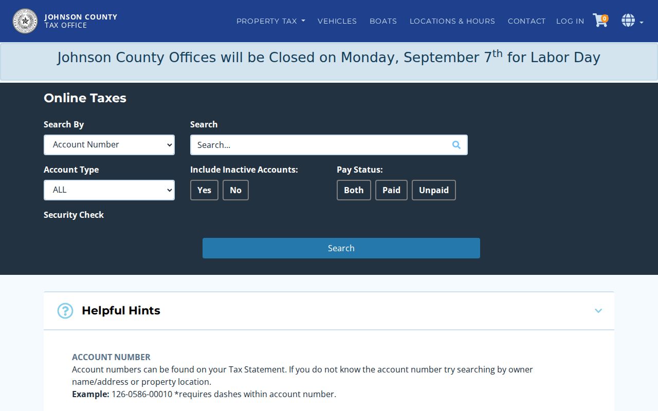
The interface is a controlled starting point for Johnson-side parcels. Tarrant-side work belongs in the Tarrant Appraisal District search, where the parcel card supplies a separate set of result fields and links.
Burleson Street Map Layers
The Burleson GIS OpenData service is the street-browse tool in this workflow. Its layers include Address, Parcel, Subdivision, Street Centerline, Zoning, Structure, City Limit, ETJ, Railroad, and other city features. The boundary service adds ZIP, county, annexation, school, fire, law, police reporting, and water-billing layers. Select the subject parcel first, then use the street centerline and subdivision layers to understand how the address sits within the street and plat pattern. The map does not itself establish the owner or every person associated with a parcel.
This Burleson GIS parcel-layer source is the address-to-parcel bridge before a county search begins.
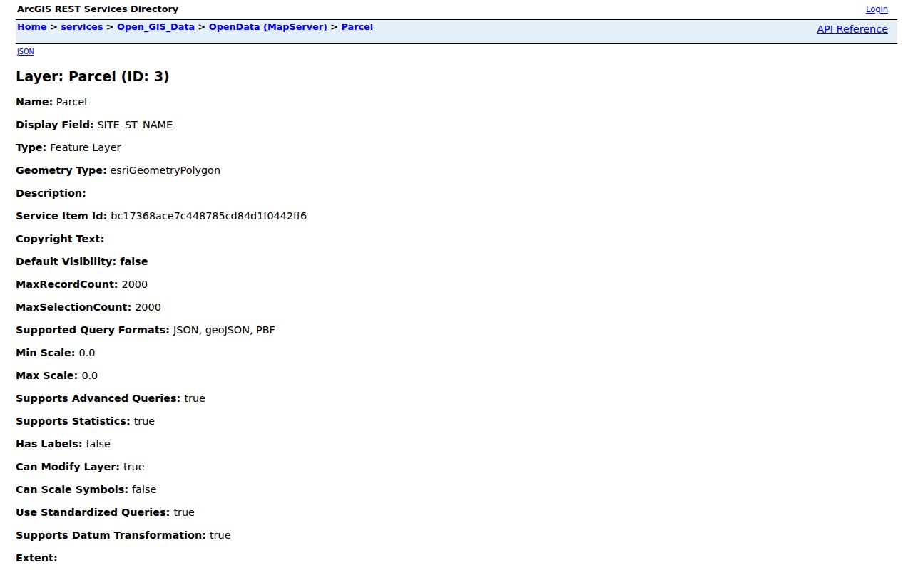
Use the map with the county boundary layer, not as a substitute for it. A parcel selected in GIS can be checked against a recorded legal description, plat, or county appraisal entry.
Burleson Street Records and Parcel Coverage
Address-keyed sources overlap, but their limits are important. Appraisal data ties fields to a parcel; recorder entries show an instrument trail; city records relate to a location and activity. Voter records are governed by state access rules and can suppress protected address data. The library and UNT newspaper collection can produce historical names, events, and street references, yet a mention on a page is not continuous residency proof. This coverage table keeps those records in their own lanes.
| Address record | What it can contribute | Burleson access route | What it cannot establish |
|---|---|---|---|
| CAD, tax, or appraisal record | Owner, mailing line, situs, legal description, value, account, and status fields | Johnson CAD or tax search; Tarrant Appraisal District | Current occupant or every household member |
| City GIS | Parcel geometry, address, subdivision, street centerline, and boundary overlays | Burleson OpenData and boundary services | Private household relationship |
| Official public records | Deeds, plats, liens, easements, and indexed parties | Johnson or Tarrant clerk index, terminal, or clerk request | Continuous physical occupancy |
| Voter records | Lawful registration or precinct context, subject to protected-field rules | VoteTexas, county elections office, or a focused request | Current residence, vote choice, or a public block roster |
| Permits and code files | Project address, named roles, work class, and inspection dates | eTRAKiT, daily map, archive, or a focused public-information request | Personal motive or present occupancy |
| Newspaper and library history | Historical street, family, organization, and event leads | Library resources and UNT Portal search | Current status or identity certainty |
Start with a parcel identifier or legal description where possible. Street spelling can shift in an older article, while a lot and block description may continue to connect a plat and a deed.
Burleson Street Directory Deed Trail
Once a parcel is on the correct county side, a deed chain runs from the current owner and legal description to the newest instrument, then from that seller to an earlier deed as grantee. Johnson and Tarrant official-record systems both expose Quick and Advanced search, Search Term, Recorded Date, and Index Only or OCR choices. Johnson’s index displayed certification through August 21, 2026, while Tarrant’s displayed certification through August 27, 2026, during research. Neither official source supplied a first online-index year, so an old gap should lead to the clerk terminal, records office, or written request.
The Johnson County Official Public Records search is an index and image route for the Johnson side of a Burleson street.
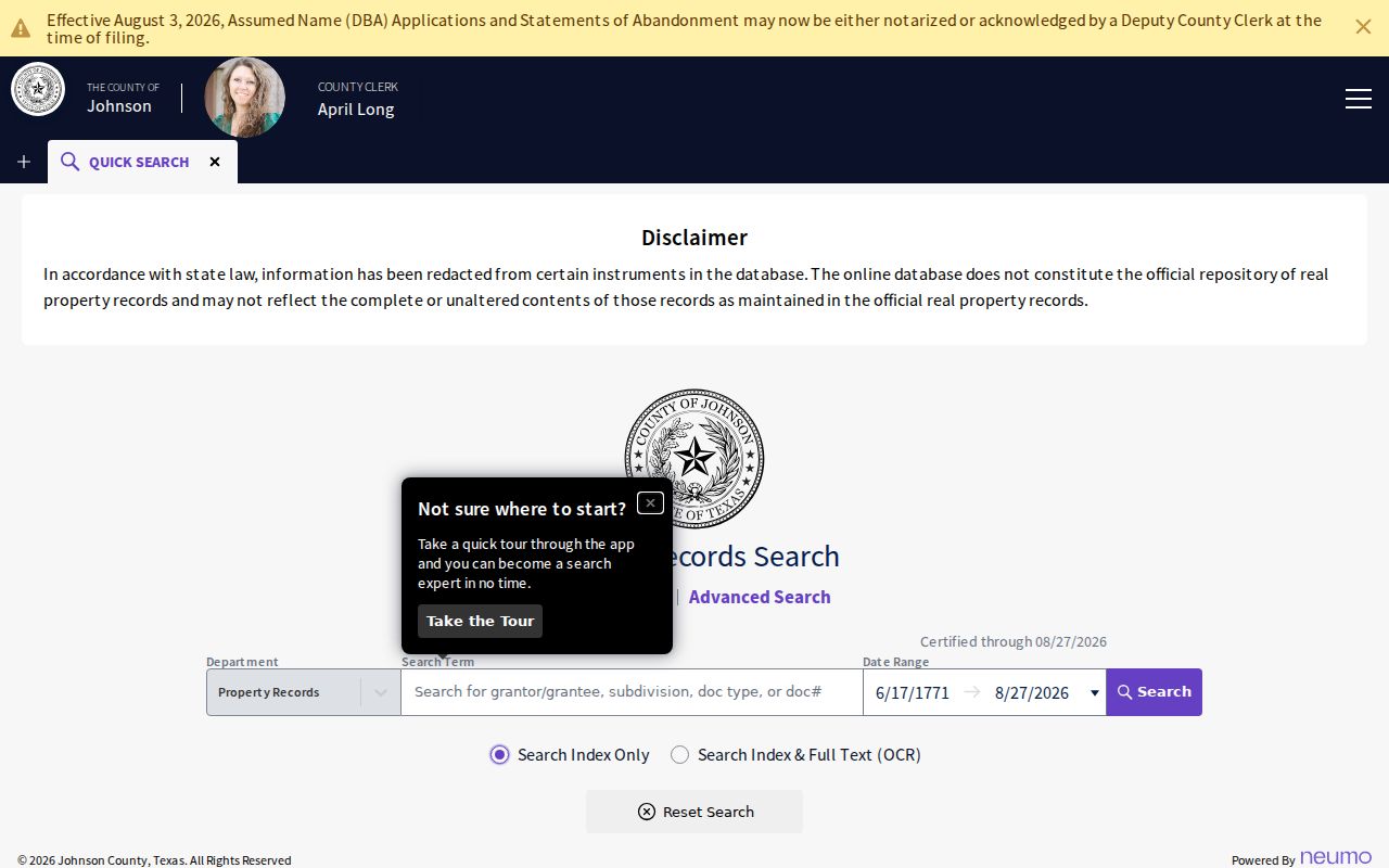
Johnson warns that its database is not the official repository and may not show complete or unaltered instruments. Preserve the result details, inspect the image where available, and obtain an official copy from the clerk when proof matters. For a Tarrant-side address, use the separate Tarrant County Official Public Records index.
Burleson Address Permit Trail
City permit material adds a dated location trail without becoming a resident list. Burleson links permit activity reports, a daily inspection web map, Interactive House, eTRAKiT permit and plan search, and code-enforcement archive categories. The available pathways can return a project address, work class, inspection date, and named applicant, owner, or contractor role. Those labels describe the record’s transaction, not present residence. For a file that is not available online, a narrow request to the City Secretary/Public Information office should name the department, address, time range, permit or report number, and preferred format.
Police records follow a separate city channel. County records requests should go to the office that holds the record, rather than a broad request that asks for everything tied to an address.
Note: The research did not capture eTRAKiT’s complete inner search fields, so its current form should be checked before relying on a specific filter.
Burleson Historical Street Leads
Modern parcel research does not replace the historical shelf. Burleson Public Library links digitized newspapers, Portal to Texas History, and in-library genealogy resources. The verified newspaper resource covers Burleson News, Burleson Dispatcher, and Burleson Star from 1926 through 2014. Search a surname, street, business, school, church, organization, and alternate street spelling, then inspect the page image instead of trusting OCR alone. Exact Burleson printed city-directory, reverse-directory, and telephone-book runs were not located in the official research, so they should be requested at the library rather than assumed.
For the collection details and a household method, use the Burleson city directory collections. A historical street result should record the year, printed name, address as printed, source page, county context, and a confidence note.
Burleson Street Record Terms
Keeping labels separate prevents a street search from making a bigger claim than its sources support. These terms appear across city mapping, county appraisal work, plats, and recorder indexes.
- Parcel
- A mapped property unit used by an appraisal or GIS system.
- Situs address
- The physical property location recorded for a parcel.
- Mailing address
- The line used for tax correspondence, which can differ from the situs.
- Legal description
- The lot, block, subdivision, or metes-and-bounds description used in an instrument.
- Plat
- A recorded map that can show lots, blocks, easements, streets, and subdivision boundaries.
- Subdivision
- A named mapped development or tract grouping searchable in GIS and recorder records.
- Grantor
- The party transferring an interest in a recorded instrument.
- Grantee
- The party receiving that interest.
- Criss-cross directory
- An address-ordered historical directory section, if a licensed scan is located.
Burleson Street Search Limits
A street address is not permission to build a profile of private life. Utility-customer names, motor-vehicle addresses, unlisted household members, protected voter addresses, and protected residence information are outside this research path. An owner field is not an occupant field, a voter lookup is not proof of current residence, and a blank public result is not proof that no record exists. Texas access rules can require redaction or show a restricted address as suppressed.
Burleson Street Records in Old Town
Burleson’s railroad origin gives older street work a local shape. The city was established around an 1881 Missouri-Kansas-Texas Railroad depot and incorporated in 1912. The Burleson Legacy Charrette describes Old Town with small blocks, narrow lots, and alleys, while the Northern Texas Traction interurban operated between Fort Worth and Cleburne from 1912 to 1931. A deed, plat, historical map, permit file, and digitized newspaper may therefore each preserve a different part of the same street history.
The 2016 newspaper project preserved 43,231 pages from Burleson-area, Johnson County, and southern Tarrant newspapers at the UNT Portal. That scale makes it a strong supplementary street source, but not a replacement for the county record custodian or the parcel map.