
Burleson Mailing Areas by ZIP
Postal geography is not the same as Burleson municipal geography. The most firmly supported local postal anchor is 76028 because the USPS Burleson Post Office and many city addresses use it. Census ZCTAs add a wider statistical picture, with several areas intersecting the city. The ZCTA overlap is helpful for research context, but USPS By Address decides the mailing result for one complete address. Preserve the original address, the returned mailing line, the county, city-limit status, and the date checked as separate facts.
| ZIP | Areas Covered | Post Office | Notes |
|---|---|---|---|
| 76028 | Core Burleson mailing area and many city addresses | USPS Burleson Post Office at 232 SW Johnson Avenue | Strong city anchor, but exact address still controls |
| 76097 | Burleson-area PO Box and local-document references | Exact current USPS city and state result was not located | Do not assert complete coverage or a preferred city label |
| 76009 | Census ZCTA partly intersecting Burleson | City-specific USPS facility not located in research | Statistical overlap only |
| 76031 | Census ZCTA partly intersecting Burleson | City-specific USPS facility not located in research | Validate the full street address with USPS |
| 76036 | Census ZCTA partly intersecting Burleson | City-specific USPS facility not located in research | Validate the full street address with USPS |
| 76058 | Census ZCTA partly intersecting Burleson | City-specific USPS facility not located in research | Validate the full street address with USPS |
76097 remains an unresolved association in the official capture. Treat it as “not located in official sources” until an exact USPS city and state result is available. The other listed ZCTAs are not a substitute for an address-level postal answer.
Search a Burleson Postal Area
A ZIP can first narrow the geographic question, then guide a more exact search. Research did not capture a verified ZIP-wide result mode for Johnson CAD, Tarrant Appraisal District, or the voter portal. Johnson tax search uses a selected search mode, Tarrant offers free text and property type, and City GIS provides ZIP polygons. Do not promise that those portals return a complete list for a postal area. Instead, establish the address, county, and parcel before using the corresponding record custodian.
- Enter the full street address and unit in USPS By Address, and retain the returned line rather than changing it from a city-name guess.
- Open the City GIS ZIP, City Limit, ETJ, Annexation, and County Boundary layers to see how postal and government geography overlap.
- Use the county side shown by the parcel or boundary information to select Johnson or Tarrant property and recording records.
- For voter information, use the correct county and the state portal’s lawful registration route. Do not convert ZIP into proof of county or residence.
Once a mailing area has narrowed an address, the Burleson street directory provides the address-keyed record trail. A ZIP is the outer boundary of the question, not the parcel-level answer.
Burleson Postal and Census Numbers
Census data identifies 76009, 76028, 76031, 76036, and 76058 as ZCTAs fully or partly intersecting Burleson geography. A ZCTA is Census statistical geography built to approximate the area served by a ZIP. It is useful for comparing broad areas, but it does not promise that every address inside the polygon carries that delivery designation. Postal routes can cross municipal or county lines while a city address remains Burleson.
That distinction is especially important in a two-county city. Use Census overlap to explain why several numbers appear around Burleson, then return to USPS for the delivery line and to GIS for the city-limit and county answer. Never backfill an old letter, deed, or newspaper item with a present-day postal designation.
Note: A historical source should retain its printed mailing label and date, even if today’s postal lookup returns a different result.
Burleson ZIP Code Map Layers
The City of Burleson General Boundaries service places a Zip Code layer beside City Limit, County Boundary for Johnson and Tarrant, ETJ, annexation, school, fire, law, and other layers. That combination is the local explanation for a mailing address near a boundary. It also prevents the common mistake of using a mailing locality as a county field. Keep the legal description, lot and block, site address, mailing address, county, city-limit status, postal result, and date in separate notes.
Use the Burleson General Boundaries map service to inspect the relevant layers together. GIS can establish geographic context, but the research does not support a claim that a shared ZIP establishes occupancy or a personal relationship.
The city boundary-layer service provides the ZIP, county, city-limit, ETJ, and annexation context used for this comparison.
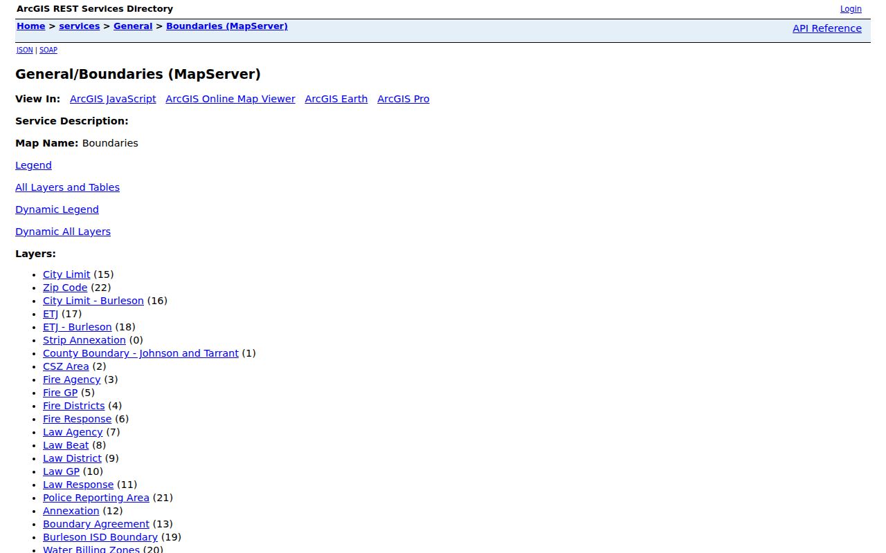
Viewing several layers at once makes the difference between postal service, municipal jurisdiction, and county custody visible.
Burleson City Limits and ZIPs
A Burleson mailing line can sit outside the incorporated city, inside the ETJ, or across county administration. Conversely, an address near a city boundary can fall in the municipal geography while using a postal area that also serves another place. City GIS and county GIS answer parcel and boundary questions. County recorder and tax systems answer custodianship. USPS answers delivery. No one of those layers replaces the others.
The City of Burleson maps page is the public starting point for the municipal map context used with the GIS layers.
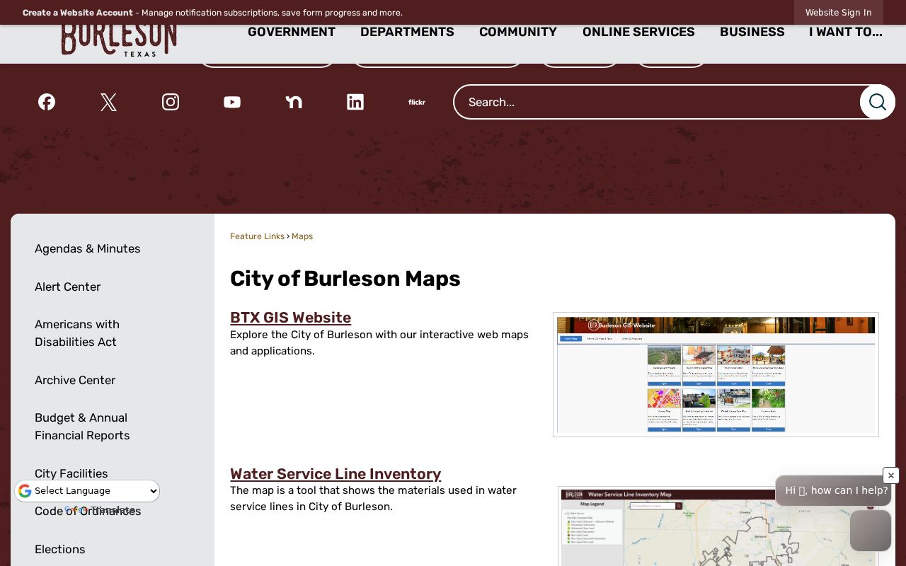
The city maps entry point helps separate municipal geography from the mailing result returned for an exact address.
Boundary check. A mailing ZIP never proves county, city-limit status, ownership, occupancy, or neighbor status. Compare USPS By Address with City Limit, ETJ, County Boundary, and parcel layers.
Unincorporated pockets and ETJ areas require an address-level check. A complete official list of every such enclave was not located, so it is safer to inspect the live layers than to label a neighborhood from a broad postal area.
Burleson ZIP Directory Terms
Postal terms describe delivery organization, not a people list. Use them to keep a mailing result distinct from a parcel record or a city boundary. A complete unit and the date of the check make the postal result more useful for future verification.
- ZIP and ZIP+4
- A ZIP identifies a broader delivery area. ZIP+4 adds a more specific delivery segment returned for an exact address.
- PO Box ZIP
- A designation used for post-office boxes. It does not establish the customer’s physical location.
- Unique ZIP
- A delivery designation associated with a single organization or high-volume recipient, rather than a general residential area.
- Carrier route
- A delivery sequence used by postal carriers. It is not a city boundary, county line, or proof of a household.
For a reproducible address note, retain the original submitted line, USPS-returned line, ZIP+4 when supplied, mailing city, parcel ID, city-limit status, county, geocode confidence, and date checked. The fields answer different questions. A parcel identifier tracks land, the postal line supports delivery, and the boundary layers explain which local record systems may apply.
Burleson Postal Directory Limits
ZIP geography is a narrowing field, not a resident-verification system. A postal result cannot confirm a person, organization, owner, occupant, or a full roster for an area. Texas voter searches have protected fields and restricted-address displays. County tax and appraisal cards distinguish mailing address from situs address. A recorded deed can show an instrument role but not continuous physical occupancy. Keep each source within its own purpose.
For a current local record question, follow the address to the parcel and county first. For a historical question, preserve the address and mailing label as printed in the dated source, then use legal description, plat, map, and recorder material to bridge changes. No verified local street-renumbering year was located, so a guessed number conversion is not reliable.
Burleson ZIP Privacy Boundaries
Texas privacy protections still apply after an address has been normalized. The Address Confidentiality Program, Election Code voter-address protections, Tax Code Section 25.025 appraisal confidentiality, DPPA limits on motor-vehicle information, and protected vital-record periods can limit what appears in an otherwise public search. A suppressed or incomplete result is not an invitation to combine records until a protected address is exposed.
Use a ZIP only to explain mailing geography or narrow a lawful records request. Remove unnecessary contact details, preserve uncertainty, and ask the original custodian for the publicly releasable portion of a record when more information is needed.